


supercharge
your inspection
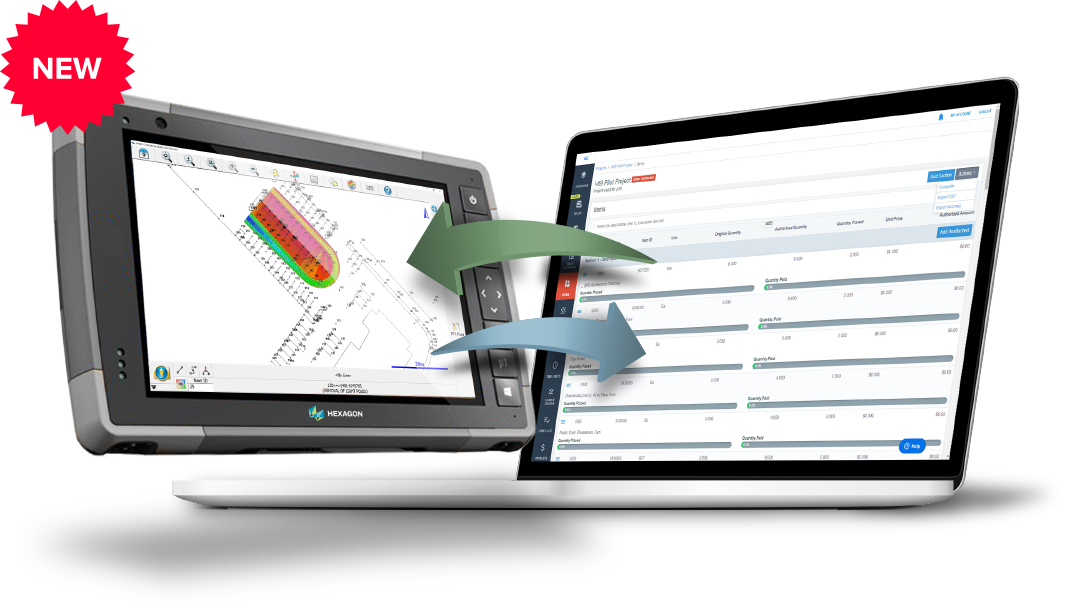
If you’re not already using GNSS Rovers to capture survey data for your inspection reports, now’s the time to upgrade. With Leica Geosystems FieldGenius software, integrated with Infotech’s Appia service, you can now quickly capture and connect all the data you need for Appia daily work reports in just a few simple steps.
Connect
Using Appia, identify the project items you want to record with your report, and import the file into the FieldGenius construction inspection app.
Record
Using Appia, identify the project items you want to record with your report, and import the file into the FieldGenius construction inspection app.
Deliver
Export your project file from FieldGenius and upload it into Appia to create your daily work report and Google Earth file.
Make strides in your workflow with the GNSS ROVER advantage
Using rovers saves a lot of time vs. manual data collection from photos and hand-written notes. Plus, inspectors don’t need to have the data verified by another surveyor, as its already survey accurate. Aside from being the only rover solution that can deliver data directly into Appia, Leica rovers are also lightweight, portable, and the simplest to use, due to innovative features like auto-leveling and tilt-correction.
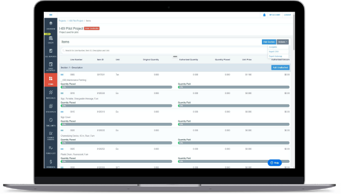
CREATING DAILY WORK REPORTS IN APPIA HAS NEVER BEEN EASIER
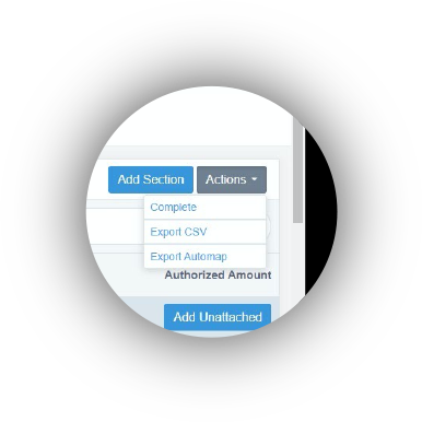
AUTOMAPPING PROJECT ITEMS TO FIELDGENIUS
Choose the project items you want to record from Appia, then easily send them directly to the field tablet with the push of a button.
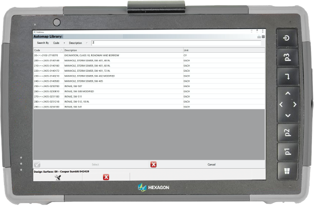
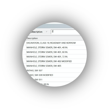
EASILY FIND PROJECT ITEMS WITH DYNAMIC SEARCH
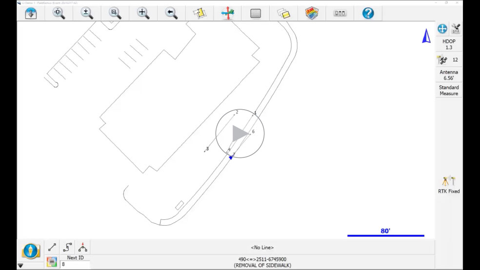
Once imported to the tablet, finding the project items for your points and measurements is extremely easy. Just start typing codes or descriptions, and the results appear instantly.
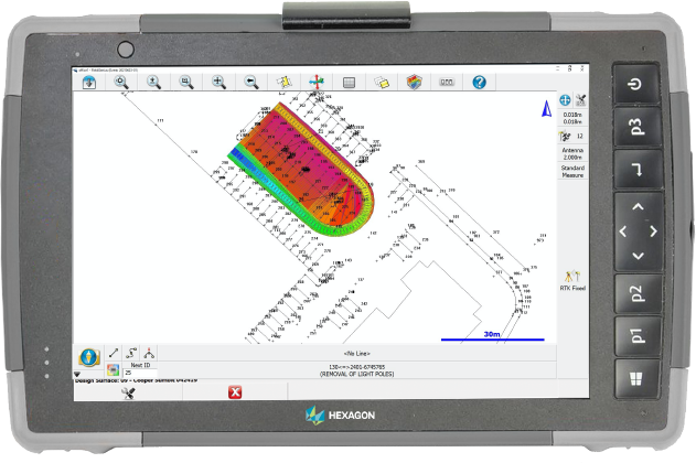
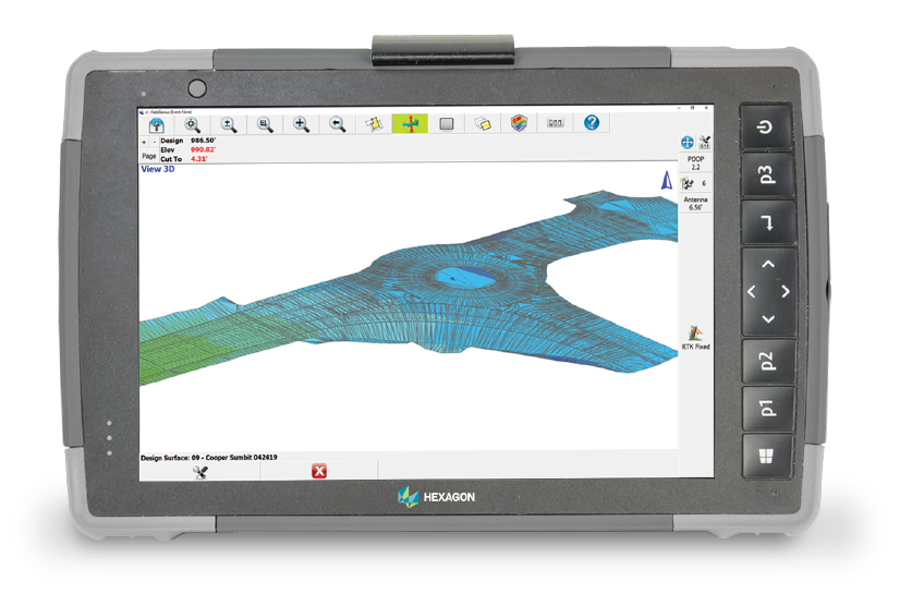
using design files in the field
Having a visual reference while collecting data reduces error and dramatically increases the speed at which you can find points, lines, areas and volumes.
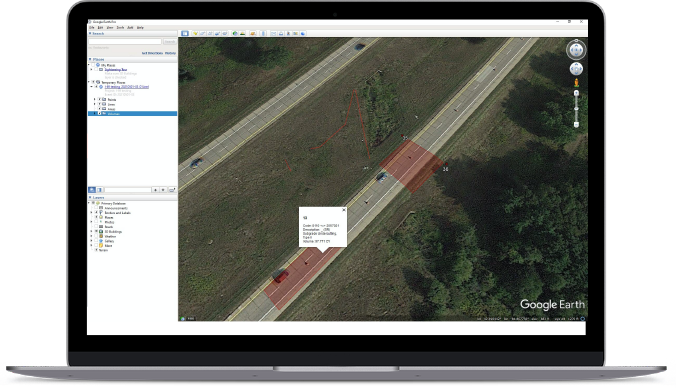
Documentation
everyone understands
The software also creates a Google Earth visual with the collected data, making it super easy to share details with the project team and direct field crews to problem areas.
SIMPLIFY YOUR INSPECTION WITH our COMPACT AND TIME-SAVING SOLUTION
Get started today with a Leica Geosystems smart rover and the FieldGenius Construction Inspection software/tablet.


GS18 I
Versatile GNSS RTK rover with Visual Positioning. Capture the site in images and measure points from them in the field or later in the office.