Nearly every building trade today uses software to conduct its work and share digital assets, from cost estimates and shop drawings to 3D models.
As an MEP contractor, your scan-to-CAD or scan-to-BIM workflow may include software for point cloud registration and analysis, project management, 3D modeling and building energy modeling. And, ideally, you would be able to share all that laser scan data with your collaborators across different platforms efficiently and easily, saving you time and money on administrative tasks.
However, that’s not always the case. In a recent survey of MEP contractors by Leica Geosystems and Construction Dive’s studioID, the most frequently cited pain point among respondents was the limited compatibility of digital files. The result: model clashes, data duplication and rework stemming from an inability for project teams to streamline workflows and collaborate in a common data environment.
How can MEP contractors overcome that hurdle to share laser scan data more efficiently and effectively? Here are three ways your project team can level up your data compatibility, starting with your laser scan data – and how Leica Geosystems’ 3D reality capture and software products can help.
1. Share your point cloud data directly from the jobsite via the cloud
With Leica’s software solutions, you can transmit your point cloud data directly from the jobsite regardless of which sensor you use, allowing you to adopt a universal workflow across your company.
Begin by confirming that your scan shows what you need by previewing it on a tablet or smartphone with Leica’s Cyclone family. You can register the point clouds directly in some scanner models or through the software. As long as your project site has a Wi-Fi signal or internet connection, you can send the scan directly from the field to your office, the general contractor or another stakeholder.
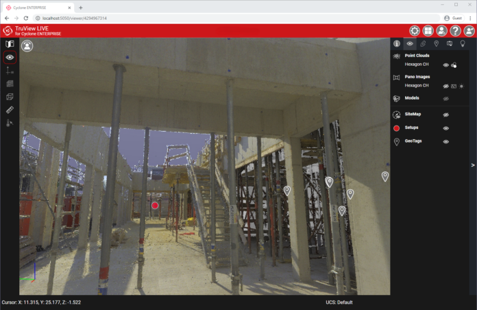
All stakeholders can view and make comments on your point cloud using Leica TruView, which is available for free and can be downloaded to a computer or accessed via a web browser.
2. Publish your point cloud to your file format of choice
For laser scan data that you have taken into Leica Geosystems’ software solutions, you can export your point cloud into many different file formats common to the building industry.
You can publish an LGS or LGSx universal digital reality project file, which contains comprehensive information — points, imagery, geotags and metadata — in a compressed, lightweight format and can be opened in any downstream software by Leica Geosystems or Hexagon, including Leica TruView.
You can export your point cloud to a third-party or industry-standard file format for opening in popular CAD and BIM programs that your team may be using for design. Examples include an RCP file for opening in Autodesk Revit, ReCap and Navisworks; a structured E57 file; the unstructured data formats LAS and SEMA; a PTS or PTX file; and a JPEG or EXR image file.
With this range of publishing options offered by Leica’s digital solutions, you can send out nearly any type of deliverable your contract or team requires.
3. Open your point cloud directly in your BIM or CAD platform
If you want to preserve the original contents of your laser scan data, you can open your point cloud directly in several popular CAD and BIM programs with a plugin. Leica CloudWorx plugins are available for Autodesk AutoCAD, Revit and NavisWorks, Bentley software, BricsCAD, Smart Review and more.
One advantage to opening an LGSx in third-party software is that the point cloud acts like an external reference (Xref) in your BIM model and doesn’t slow down your hardware’s processing speed. You can then save and share the CAD or BIM file with the referenced point cloud with your team.
These three sharing strategies exemplify how Leica Geosystems offers flexible and versatile workflows for the MEP contractor.
And don’t forget: Once you have selected a post-processing workflow that works best for your company, you can use it with whatever Leica sensor you choose. By standardizing your workflows, you increase efficiency and productivity across your company and can easily scale as you grow.
To explore laser scanning solutions and discuss your needs with a building construction specialist, contact us.


