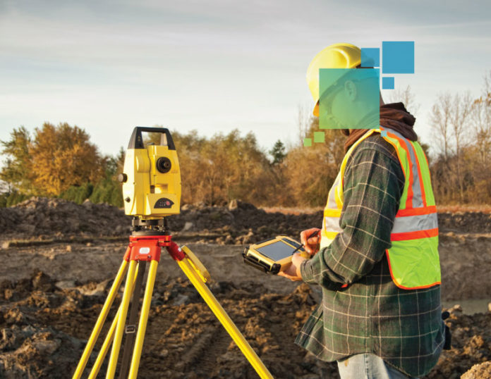
If you’ve decided to invest in total station layout, you’ve taken a good first step toward providing BIM services. However, how do you know what type of total station you need?
Prism vs. Reflectorless Total Stations
There are two ways the total station measures: using the traditional and still more common prism, or through reflectorless technology.
With the prism method, the total station sends out invisible infrared waves that are reflected by the prism, which is typically attached to a pole. By measuring the prism’s position and knowing the precise angle and distance to that prism, the total station calculates the prism’s location or coordinates. Measurement to a typical 360 degree prism is roughly 5,000 feet (1500 meters), and measurement to a standard round prism can reach as far as 9,800 feet (3,000 meters). A 360 degree prism can face any direction, whereas a standard round prism only has one face that must look toward the total station.
Consider an application in which a stub-up needs to be located. The instrument is set up in the dirt off the building pad, and the person holding the prism pole, with the field controller attached, is guided by the field software to the correct location. The total station “tracks” the prism and continuously updates its position in the field software. When the exact position is reached with the prism, the field software displays a confirmation message.
The reflectorless method does not use a prism. Instead, it uses a visible red laser beam that allows the user to layout or measure points from any surface that is able to reflect it. The reach of the laser beam varies between instruments – it ranges from 1,300 feet to 6,500 feet (400 to 2,000 meters).
When determining which method to use, consider the location and logistics of the area being measured. A prism pole allows the instrument to reach places and measure points that can’t be achieved using a reflectorless method — for example, measuring around piles of building construction materials or other obstructions where a laser beam is unable to reach the desired point. In these cases, a prism and prism pole can be used to measure above the obstruction. Likewise, when trying to measure around an overhead beam or rafter, the prism pole can be inverted to allow measurement of a location unable to be seen directly with the red laser. Reflectorless technology can also help makes job sites safer. For example, if you need the length of a beam two stories high, you simply aim and shoot points at each end of the beam and you are done – no ladder or scaffolding required. Whether you need to measure hard to reach locations inside buildings, outside of buildings or on the site around the building, reflectorless measurement technology helps keep human out of harm’s way.
Manual vs. Robotic Total Stations
Manual and robotic total stations are available as both reflectorless and prism models. The biggest difference between these two types of total stations is that robotic total stations have a motor so they can be controlled remotely instead of manually.
The manual total station is a two-person operation. The instrument must be manually turned and the prism must be sighted each time. The electronic distance measurement (EDM) also must be triggered each time.
The robotic total station is a one-person operation. The station automatically follows the prism and is continuously measuring with the EDM.
When determining which total station and method is best for the job or operation, consider these points:
- A robotic total station has a two-to-one labor ratio and enables the layout of 25 percent more points per day compared to a manual total station.
- A tape measure and plumb bob requires two to three people and allows for the layout of about 200 points versus about 600 points with a robotic total station.
RELATED: The ROI of Digital Layout
What method of construction layout do you use, and what are your biggest challenges? Share your comments below.
For an overview of totals stations for various applications ranging from construction and surveying, building and construction, surveying and engineering, and engineering and monitoring, go to https://leica-geosystems.com/en-us/products/construction-tps-and-gnss.


