Against the New York City skyline, Central Park Tower stands out for its cantilever design and its stunning supertall height. Rising 1,550 feet into the air, the building is the second-tallest building in the Western Hemisphere and the tallest primarily residential building in the world.
Ensuring the vertical alignment of the internal core-wall structure was no small feat. Pinnacle Industries II, the concrete contractor responsible for building the structure, needed reliable coordinates for layout before each new floor was built. On a smaller building, surveyors would use optical instruments to do this from the ground, but establishing location with transit levels becomes impossible once the building rises above the instrument’s line of sight.
Instead, Robert Mandelbaum, survey engineer for Pinnacle Industries II, used a GPS solution—the Leica Geosystems core wall survey control system.
Control Points Move with the Floors
The core wall system uses GNSS receivers placed on the outside of a building as control points that move up as floors are completed. The GNSS sensors produce highly accurate 3D position coordinates that allow the construction team to reliably and quickly adjust the alignment of the forming traveler used to locate and lay out the building slab edges, columns, and walls on each floor.
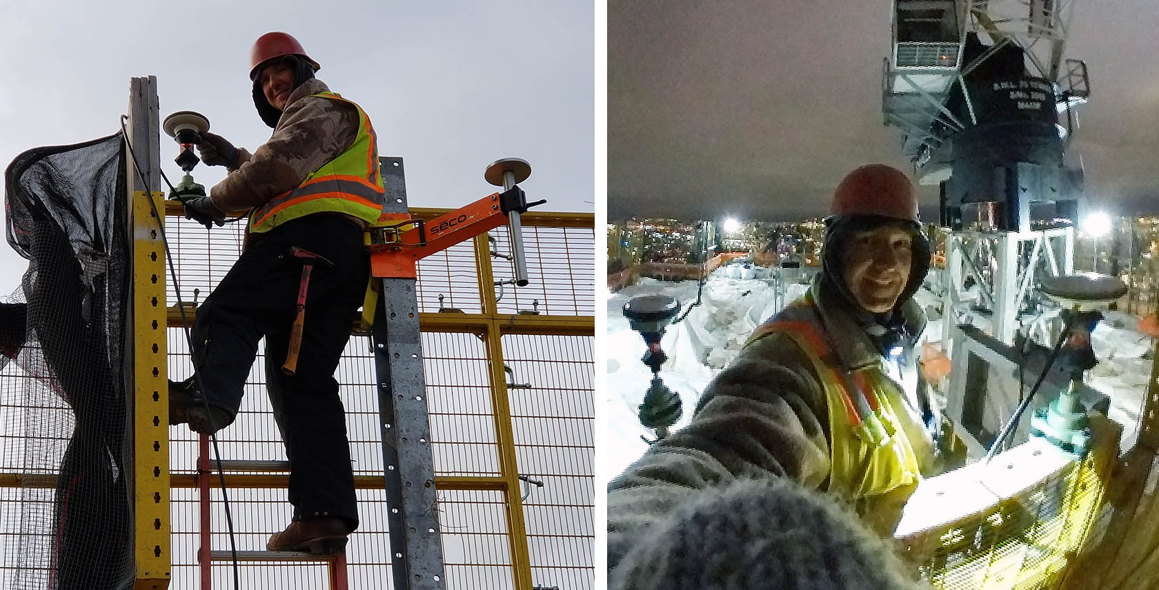
For the Central Park Tower construction, the system used four GNSS antennas with co-located 360-degree prisms and a base station receiver. The equipment was attached to the hydraulically climbed protection screen enveloping the building structure.

“I didn’t have to worry about me physically moving it up because it was fixed to the inside of the screen,” Mandelbaum explains. “The GNSS antennas, I would place on the perimeter, on each corner of the building as far as I could from each other. They would give me coordinates, and using that I was able to establish control lines.”
System Provides Reliable, Repeatable Accuracy
Accuracy was crucial. “To verify that the access lines or the control lines stack from floor to floor, every 10 floors, I would use an old school piano wire—literally a piano wire—and drop it through a corner,” says Mandelbaum. “I would tie a good 80 lb weight to the bottom of it, and I would physically check with a rule to the access lines on the floor, to the control lines. And it was there, within a 16th of an inch (1/6 inches = 1.55mm accuracy). It just proved that it’s right.”
A Leica robotic total station was also used to establish the position of the control lines, acting as another independent check of the solution that could be referenced against the antenna readings. The total station positioned itself via prisms co-located under the GNSS antennas.
Mandelbaum explains, “I would know where each antenna is according to the solution on the laptop. I would take the antenna that’s the farthest away from me, and I would look for the time solution as well. I would be at the same time slot and shoot (measure with the total station) the antenna. And if it’s the same number that I see on the laptop, within a few thousandths, then I will use it.”
Software Provides Real-Time Access to Data
Despite being new to the GNSS system, Mandelbaum and his partner found it easy to use. Leica GeoMoS software provided easy access to the real-time data essential for establishing control lines. “There were a few steps I needed to learn, and that was that,” Mandelbaum says. “It was a piece of cake.”
Construction of Central Park Tower was completed in 2020. After experiencing the benefits of the Leica core wall system, Mandelbaum plans to use it again in the future if he can. “It has a track record that it works,” he says.
To learn more about innovative solutions for building construction, contact our experts.
Note: A version of this article originally appeared on the Leica Geosystems website.


