By Travis Rauscher and Bryan Baker
Over the years, drones, and specifically civil and structural engineers’ attitudes toward these tools, have changed.
Once viewed as a gimmick, drones have proven to be indispensable, dynamic, and flexible tools helping to lead the technological and autonomous revolution on the modern jobsite.
The number of drones, or unmanned aerial vehicles (UAVs), has continued to grow, and the Federal Aviation Administration (FAA) reports more than 314,600 commercial drone registrations in the United States.
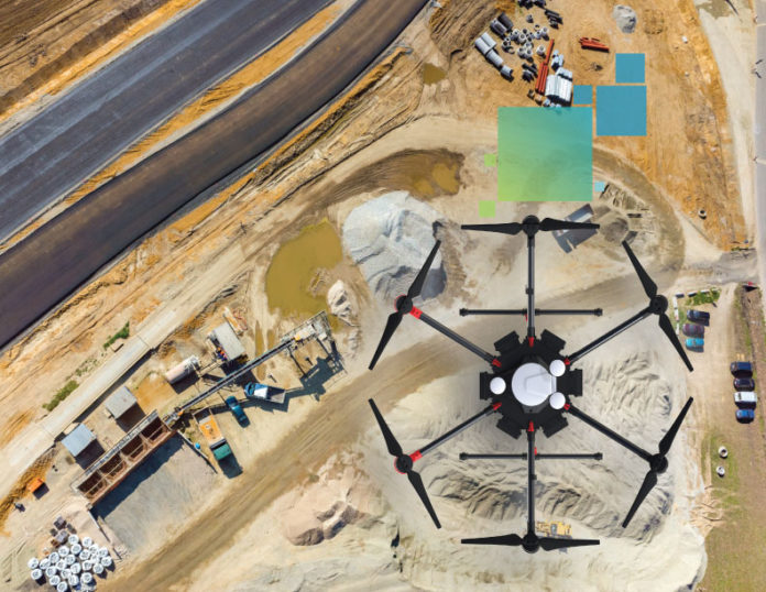
Structural and civil engineers use drones to quickly capture high-resolution images of current conditions and updates as work progresses. Drones capture images from multiple angles, tagging each image with coordinates.
They deliver highly accurate orthophotos, 3D models, and high-density point clouds, which is more detailed than traditional ground-based topographic surveying. Drones allow engineers to quickly gather data and provide the detailed information they need to make real-time decisions.
Engineers can deploy drones during every project phase — from surveying to verifying a project’s construction in real-time to final build verification.
The alternative would be to use satellite imagery or a flyover with an airplane or a helicopter to capture images of a jobsite. While both have benefits, they cannot capture the same level of detail as they operate at a higher altitude, generally cost more, and depend heavily on atmospheric conditions.
New technologies such as drones are bridging the gap between understanding what is happening on a job site and acting on it. As a tool, drones can help engineers streamline processes, lower costs and, ultimately, increase efficiency, all while helping teams ensure they follow best industry practices.
Versatility is key.
Traditionally, capturing a building manually is likely to take hours, and the team might not be able to reach places that are too costly or dangerous. Conversely, drones can capture hundreds of thousands of data points per second and millions of data points in hours.
Using Simultaneous Location and Mapping (SLAM) spatial awareness technology, drones collect data to map their environment.
SLAM technology integrated into a solution’s Visual Inertial System (VIS) leads to a more complete data capture, making the operation less manually focused and reducing the risk of human error. Combined with onboard RTK GNSS positioning, drone data is quickly georeferenced with other measured site data.
Once teams have the needed data, they can easily share it with off-site colleagues and integrate it with other software solutions. Drones are ideally suited to complement the other, sometimes manual, processes used on job sites, helping solve once complex workflows with a straightforward solution that meets the moment’s needs.
Engineers verifying the status of a project have incredible insight and a complete view of a project’s progress, eliminating the guesswork and ensuring that all decisions are based on facts.
Teams can go further by automating when and where a drone scans, allowing drones to capture the data needed as a project progresses.
Despite the many advantages, drones have a few limitations, though the benefits far outweigh the constraints.
The United States has put in place various regulations governing drone operations. Drones are also a largely fair-weather tool, meaning they can’t be used in extreme weather conditions, such as locations with too much wind or where extreme hot or cold temperatures are present.
However, any challenges to widespread adoption of the use of drones are easily overcome with some minimal planning.
The drone’s evolution is building the site of tomorrow.
The jobsite has been moving toward technology for years, and the broader use of onsite technology positively impacts many aspects of the job site, from productivity to safety.
Technology such as drones is not merely another tool in the toolbox. Technology is a professional partner that enables civil and structural engineers to drive their businesses forward.
Initially, companies envisioned that every project manager would have a drone to use when they needed to capture data or check a site’s progress.
That approach evolved, and companies began assembling highly specialized drone teams rather than training multiple project managers on staff. These teams would go from one project to another to capture data as needed and share it with a project manager.
The evolution has come full circle, as companies now realize they don’t need to have highly specialized operators within their organization to use drones effectively. New drone technologies have made it easier for teams to pilot and gather the necessary data.
While the widening adoption of drones by civil and structural engineers is a step in the right direction, there is an opportunity to increase adoption.
As the world continues to emerge from the pandemic and face new challenges, new solutions will help mitigate any lingering effects and help offset new challenges, whether the ongoing skilled labor shortage or the effects of inflation. Technology is the key to weathering these potentially disastrous changes and maintaining a focus on the most critical tasks at hand.


