


Digital construction has become the standard for the building construction industry as we aim to work better, faster and smarter. But for many construction professionals the move to digital construction can seem challenging. If manual processes have always worked for you, then why do you need to change from using tapes, strings and plumb bobs? Where do you even start? Will digital be too difficult?
With Leica Geosystems manual construction total stations, you can continue to do what you do today but in a quicker, more accurate and reliable way. Using software designed specifically for the construction industry, it’s the ideal first step on a digital journey that can give you a full return on investment within only a few projects.
Why move to digital?
Simply put, digital processes are faster and more accurate than manual. Working with tapes and strings can get the job done but is often time-consuming, requiring repetitive checking and adjustments, especially over longer distances. It has a huge margin for error which needs to be controlled by managing many different factors, including:
- Making sure that the tape or string doesn’t move
- Calculating and ensuring the right angle or degree is measured
- The distance that needs to be measured
- The complex nature of the layout e.g. arcs, slopes
- The working environment (indoor or outdoor) and any obstacles on site
Having an evolution of the workflow that enables you to work directly with created or imported design data is easier. The instrument does the calculations to guide you to the layout positions. Construction professionals can still work with nails, control lines or control points as a base of reference and not only increase the speed and accuracy of the layout but also reduce the risks of wrongly laid out positions and therefore the risk of rework. In fact, you can easily be twice as productive on-site and layout double the amount of points than previously possible.
How do I know it is right for me?
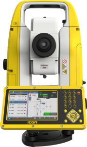
If it is your responsibility to layout points and lines on a project then the Leica Geosystems manual construction total stations, the iCB50 and iCB70 are definitely for you. Where the surveyor’s role ends, putting in the grid lines/nails and control points, the iCON tools give you all the benefits of completing the layout and measurement tasks with an interface that was specifically designed for construction professionals. It includes:
- Setup to control lines, grid lines or as-built walls and easily align to design data
- Sketching app to create design data on site or add missing elements
- Simple layout process to guide you to the point with colour coded quality indicators
- Layout lines, parallels and perpendiculars with ease
- Checks app to verify correct placements of structures on site
How long will it take to learn to use the software?
Not as long as you might think. Custom built and construction-tailored the Leica iCON build software is designed with construction professionals in mind. The innovative software design, smart digital workflows and easy-to-understand interface mean that it is simple to use and quick to master, letting you layout and measure more points per day, with less mistakes and rework. The user interface is also consistent across all of the Leica iCON solutions so once you have learned one, you will be ready to easily use all other complementary solutions and instruments.
You will be fully backed up by local support and training, through Leica’s Active Customer Care. With our phone hotlines you can speak to an expert and get questions answered whenever you need, whether you’re stood in a field or back at your desk. You also benefit from web-based support, online seminars and customised training courses. Our customer care is developed to make sure that you get the best from your investment: so you have minimum downtime and can improve the quality of your work.
As the digital capabilities for construction grow, robotic total stations will increasingly become an essential tool for layout, as-built, and verification tasks. At Leica Geosystems, we’re continuing to develop our iCON robotic solutions to support new processes and workflows so our customers can gain even more efficiencies in the future.


