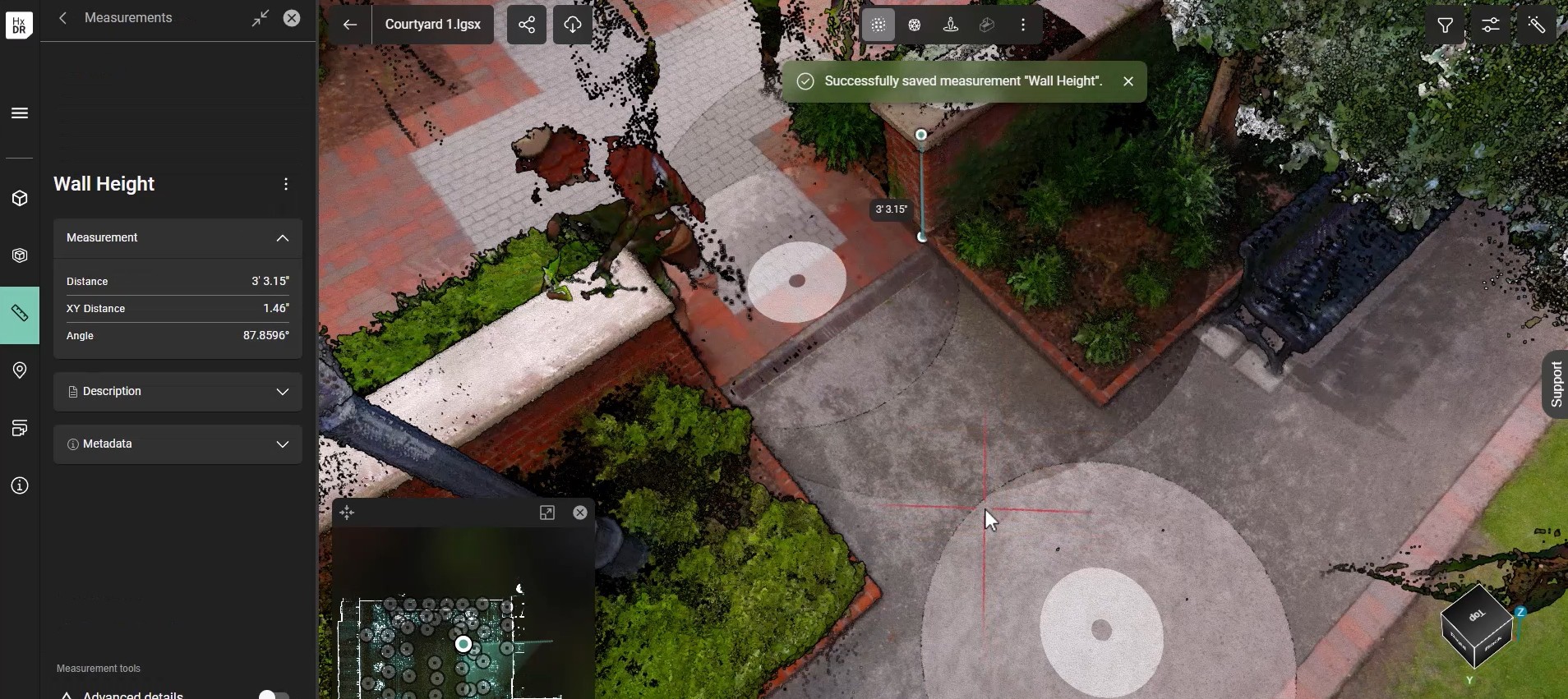
Site surveys are the backbone of successful renovations and construction projects, but traditional methods often leave room for costly mistakes and missed details. Enter beginner-friendly laser scanning, a technology that’s transforming how professionals capture, visualize, and collaborate on site data. In a new video, Reality Capture Consultant Adam Westfall, PS, walks through a scenario using the Leica BLK360 imaging laser scanner.
Why Traditional Site Surveys Fall Short
Even on sites that seem straightforward, hidden complexities abound. Landscape lighting, gas-powered lamps, wall heights, and tree sizes are just a few elements that can be overlooked. When stakeholders—such as project managers, engineers, architects, and owners—need more information, return trips to the site quickly drive up costs and delay projects.
How Laser Scanning Closes the Gaps
Laser scanners use pulses of light to measure distances and capture millions of colorized points, creating immersive 3D models and panoramic images. If you can see it, the scanner can see it, ensuring comprehensive coverage and minimizing the risk of missing critical details. The process is intuitive: start in open areas, move the scanner around for different perspectives, and watch as scans build into a complete project file in real time.

Efficient, Collaborative, and Detailed
With cloud collaboration platforms like Reality Cloud Studio, powered by HxDR, data uploads happen on the way back to the office, making it possible to start working immediately. Stakeholders can access measurements, panoramic images, and even collaborate remotely, eliminating the need for countless site photos and reducing the chance of rework. Features like quick linking of scans and density adjustments speed up the process without sacrificing detail.
From Field to Deliverable—Fast
Laser scanning streamlines workflows, allowing teams to draw directly from point clouds, extract features, and create topographic maps. The result? Faster turnaround, fewer site revisits, and richer data than traditional surveys. In one example, a site was scanned in just over an hour, with deliverables ready by the end of the first day—a win-win for everyone involved.
Smarter, More Efficient Site Surveys
Beginner-friendly laser scanning isn’t just about technology—it’s about smarter, more efficient site surveys that save time, reduce costs, and deliver better results. For project managers, VDC managers, engineers, and architects alike, it’s a powerful way to expand services and exceed stakeholder expectations.


