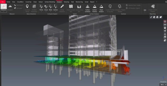
Upon winning a project bid, you know better than to rely on design drawings or a building information model (BIM) likely created with manual field measurements. Instead, you conduct your due diligence and document existing conditions with a laser scanner. With the accuracy and speed of today’s 3D reality capture hardware, the scanning process is straightforward.
However, converting that point cloud into a digital deliverable that can be analyzed and shared with other trades and stakeholders can be time-consuming if you don’t have an optimized workflow in place. Reliable and easily transferable data is crucial to keeping projects on time and on budget.
Here are three steps for getting the most out of your laser scans.
1. Make Sure Your Laser Scan Hardware Is Fit for Purpose
The purpose and subject of your scan can vary widely in type and size.
“Because all facilities are complex, you must have great equipment — and it’s not one-size-fits-all for scanning existing conditions,” says Ted Moberg, building construction product marketing manager at Leica Geosystems. To optimize your scanning process while getting the deliverables you need, consider using a combination of technologies that balance speed with accuracy.
A stationary terrestrial laser scanner is appropriate for complex spaces, such as mechanical, electrical and plumbing (MEP) rooms, in which a high level of detail and accuracy is required for laying out and sizing equipment. In corridors and rooms that are more straightforward, a handheld, mobile scanner may provide the accuracy you need, but with a faster scan time.
“Having a fit-for-purpose toolkit for laser scanning is not just a trend, but also a best practice for capturing conditions,” Moberg says.
2. Make Sure Your Laser Scan Software Matches Your Needs
Software requirements also vary based on the purpose and subject of your scan. If your goal is to get a digital representation of site conditions to track construction progress, coordinate trades, or compare built work against the design BIM model, you can stick with software that generates 3D surface meshes from your point cloud.
By turning the millions of points into solid planes representing real-life surfaces, such as walls, floors or ceilings, you can avoid the time-consuming task of manually creating a BIM model from your point cloud. “This is the path that I would recommend for any team that doesn’t have a contract requirement to produce a high-level of detail BIM model at closeout,” Moberg says.
Some tasks require the full capabilities of a BIM solution such as Autodesk Revit or Navisworks — for example, if you need to update the design or federated BIM model with as-built conditions captured by your scan, run a comprehensive clash detection analysis or deliver a final as-built BIM model embedded with object information and operating and maintenance data. In this case, you will benefit from a plugin that can open and manage your point cloud directly in your BIM solution, such as Leica Geosystems’ CloudWorx plugins.
3. Take Advantage of Artificial Intelligence
Software that offers automated and AI-powered features is ideal for attaining any digital deliverable today. Though the holy grail of an algorithm that automatically converts a point cloud into a classified BIM model does not yet exist, Moberg says, some software tools can automatically identify common objects and surfaces — like walls and doors — in point clouds and segment them appropriately into a 3D mesh.
“You don’t have to do manual segmentation,” Moberg says. The AI tools can’t handle high-detail piping yet, but he believes they will get there.
If your project is updating a federated BIM model, you can use AI software to automatically detect changes between as-built conditions and design intention throughout construction.
“By comparing the real-life scan environment to the model environment, AI-based tools can calculate the percent completion of construction and the deviation of as-built conditions against the design model,” Moberg says.
The tools can also predict potential clashes of infrastructure based on detected construction deviations, he adds.
An accurate accounting of construction progress is critical to ensuring a project stays on schedule and that trades are billing accurately for completed work. Catching construction deviations in a timely manner can minimize potential safety issues and the need for expensive rework. Furthermore, if the deviations are deemed acceptable, AI-powered tools can update the BIM model, reducing the time and expense of creating a final as-built model at project closeout.
By standardizing an efficient scan-to-deliverable process and making use of the latest AI technologies available, your company will not only save time and money, but also help lead the construction industry in its digital transformation. “You’re giving people tools to advance from more traditional and manual ways for verifying their work and for collaborating,” Moberg says.
To learn more about how Leica Geosystems can help your team make the most of its laser scans, contact us.


