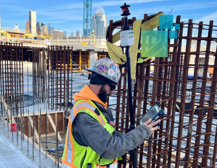
Concrete contractors looking for a way to gain efficiencies in layout have been testing a new prism pole system that promises significant time savings—and achieving extraordinary results.
The Leica AP20 AutoPole is far more than just a prism pole. Through advanced inertial measurement unit (IMU) technology and the latest automation, the AP20 has tilt compensation that eliminates the time-consuming step of stopping to level the pole. You can even flip the prism pole upside down if needed. The system automatically captures and records all measurement details in the iCON field software as you move.
When you need to adjust your pole height, the AP20 AutoPole automatically updates the correct pole height within the iCON field software. Additionally, its target recognition functionality, which Leica calls TargetID, ensures your total station locks on to your target and remains locked until your job is done.
RELATED: Go behind the scenes with Michael James to discover how the automatic pole height, tilt, and target recognition capabilities of the AP20 AutoPole are changing how contractors approach layout in building construction. WATCH NOW >
“Used the Leica AP20 pole to layout 24 concrete columns and 2 elevator cores on top of a concrete slab we poured yesterday. We then followed that up with a complete as built and topo of the same slab,” said Line and Grade Manager Nick Bush in a LinkedIn post. “What usually takes 2 guys over 2 hours to do, took us about an hour to complete. The tilt option, target ID, and automatic height adjustment is a must have if you like efficiency and accuracy. The AP20 pole, Leica iCR80, and iCON v7.5 software is the best setup I have ever used.”
Connect with a building construction expert to learn more or request a demo.


