


Taliesin West, Frank Lloyd Wright’s winter home and desert laboratory, welcomes more than 100,000 visitors per year. Not everyone can travel to Scottsdale, Ariz., to tour this architectural treasure, but today, anyone around the world can take a virtual tour of Taliesin West thanks to a recent project combining cutting-edge laser scanning technology from Leica Geosystems, part of Hexagon, with 3D cameras and visualization software from Matterport. During the winter of 2017, I received a call from Eric Cylwik, a friend of mine in the Phoenix area who works at Sundt Construction, asking if I would be interested in digitally capturing Taliesin West. Without even knowing the details I said YES, and my mind started to run wild with ideas. After meeting Jeff Goodman and Fred Prozzillo from the Frank Lloyd Wright Foundation, I knew this was going to be both an amazing opportunity and a significant challenge.
Experimenting with Innovation
 The technologies we wanted to use, the Leica BLK360 imaging laser scanner with the Matterport Pro2 camera and Matterport software, had never been used together to capture a project of this scale. From the start, we did not know how we were going to accomplish the project or if it was even possible. During my early conversations with the Frank Lloyd Wright Foundation team, I told them that I was not sure what the outcome would be, but I would certainly give it a shot. Any time I voiced concerns to the group about the results of combining Matterport with the BLK360 scanner, the team repeatedly said that this is Frank Lloyd Wright’s laboratory where he would try new building ideas and experiment with structural elements and construction materials, so what better place to try new technology! This positive attitude, along with the knowledge that so many amazing things have happened here, gave me the confidence that we could succeed with this project.
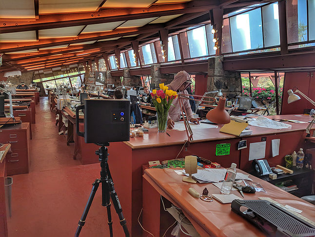
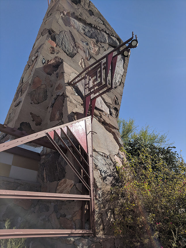
The beautiful Taliesin West site spans 600 acres with many structures spread across the main area. The history of Taliesin West is amazing, and being able to experience it firsthand is a memory I will cherish forever. The day we were scheduled to start, I arrived onsite with a clear head, a Leica BLK360, Matterport Pro2 camera, iPad Pro2 and countless backup batteries. It was time to get going and see if all my testing, planning, coordination and software would pay off. There was just one problem: It was raining! While some laser scanners can scan in the rain, the BLK360 cannot. Like other entry-level laser scanners, it also doesn’t like puddles. I decided to start inside in an area I knew would provide the best results.
Pioneering an Approach to Switch Between Sensors
I often tell people that using the Matterport capture app for data collection is like using a paint brush: You need to start in the center and work your way out or though the building and exterior campus. This approach gives the Matterport capture app more features to align with along possible routes, like a maze.
The Matterport Capture app we used on this project was a private beta release developed through the partnership between Leica Geosystems and Matterport. The day before I left for the project, I had a call with the Matterport developer. He told me I was nuts and the software was not stable. Matterport could not guarantee that it would work or what the results would be. Trying something so new gave me a pioneering feeling. I had done as much testing as possible at home to understand some of the limitations and workarounds. Despite knowing that this would be a difficult task, I had the optimism to persevere.
I started scanning with the Matterport camera in an area of the School of Architecture with good success. Then I added a BLK360 scan every 20-40 feet. That worked well. Having the ability to switch between sensors was fantastic.
Combining Sensors to Capture Data at a Distance
The rain stopped in the morning and the sun came out, so I decided to move outside. It is important to note that a breakthrough for Matterport was being able to consume BLK360 sensor data that could capture data at longer distance, allowing for Matterport to create models of exterior areas. This capability was extremely important to the Frank Lloyd Wright Foundation as there is so much value in being able to share the full Taliesin West experience of the interior and exterior of the campus.
I started by using the Matterport Pro2 camera, which can do some exterior data collection if it is close to a building. The time came to see if we could switch sensors and begin capturing exterior Matterport content with the BLK360. When switching devices, I learned that collecting the same data from both sensors in the same spot helped the Capture app identify where in the model the scan started based on existing data. From there, the software could automatically align the new data. I like to think of it as the data leading the software by saying, “I am here,” and then adding new data saying, “I am going there.”
The switch to the BLK360 and initial exterior scan went well. It was time for the moment of truth: To see if it we could capture at 20-30 feet. IT WORKED!! While it was extremely slow, taking 6-10 min per scan depending on the density and image settings, the data was collected and processed flawlessly.
We repeated this process over two additional site visits with two software upgrades, one firmware upgrade and one rain storm. In all we captured 900 scans and 10 billion points of data to build the full immersive model that everyone in the world can experience in the Frank Lloyd Wright 3D Laboratory.
This is just a small portion of the incredible journey to capture Taliesin West. Learn more about the Taliesin West data capture in May on a USIBD webinar and at SPAR/AEC Next, or hear the Foundation speak at HxGN LIVE 2019 in Las Vegas June 11-14.
Note: This post also appears in Brian’s blog, Chronicles of A Technology Addict.


