In transportation infrastructure and heavy civil construction, innovation is the driving force behind progress. FAM Construction, LLC (a joint venture between Ferrovial Construction and Allan Myers, VA), is at the forefront, leading the way in harnessing reality capture.
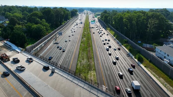
FAM Construction recently completed the Transform I-66 Outside the Beltway project, a 22-mile roadway expansion initiative for a crucial Northern Virginia thoroughfare. The project included the addition of two supplementary express lanes, three standard lanes in each direction, comprehensive interchange improvements, the introduction of toll roads, the establishment of park and ride facilities, and the integration of shared use pathways.
The Transform 66 Outside the Beltway Project in Fairfax, VA, shows what’s possible when you combine innovative thinking with state-of-the-art reality capture. Watch the video to see how FAM Construction applied reality capture to provide valuable insights throughout the project.
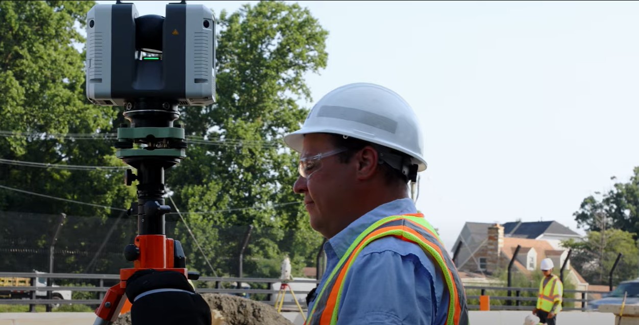
To estimate quantities and document construction progress, the company used laser scanning. “It’s impossible to do what we did in this project without reality capture,” says Gabriel Jimenez Lopez-Alegria, survey manager for FAM Construction.
Accurate Quantity Estimates and Progress Tracking
For such a complex and dynamic project, FAM Construction needed to track daily quantity estimates of key materials and produce a monthly report of overall project development. To do this, the crew shot a GPS control target for each scan setup and then scanned stockpile volumes to measure their depletion. After each scan, they had a point cloud of the area down to millimeter-level accuracy for volume and earthwork calculations.
The company began with the Leica BLK360 imaging laser scanner and then quickly upgraded to the Leica RTC360 laser scanner that allows for full accurate scans under one minute each. The team also utilized the scanner for monitoring retaining walls, ensuring design tolerances were met during bridge work, and checking verticality of H-piles.
Enhanced Collaboration and Productivity
Reality capture through laser scanning creates an abundance of information that assists with cross-team collaboration and productivity. In addition to tracking quantities, FAM Construction used laser scanning to document construction from design to reality. Scans of walls, bridges, and watersheds were sent to office staff, who could evaluate the progress and ensure the as-builts matched the design.
FAM Construction used to utilize GPS for tracking, but Gabriel explains that the process was inefficient since only single points could be measured. Key information could easily be skipped in the data gathering process, resulting in an incomplete picture of the project. For example, the field tech might collect data on the bottom of a slope but not on the top because it was inaccessible.
“With the scans, you have everything,” Gabriel says. “You can see it, and the person in the office understands it perfectly because they can see it in the point cloud. It’s so fast and powerful.”
A Competitive Advantage in a Labor Shortage
Gabriel sees next-generation reality capture as a way for companies to remain competitive.
“Digital transformation is at a boiling point right now in construction,” he said. “You can’t fall behind. It’s critical for the business to be competitive. The efficiency of our process depends on the ability to work with current and accurate information.”
In addition to boosting the productivity and efficiency of companies by providing near real-time access to the job site, reality capture allows heavy construction companies to operate in an era where finding experienced surveyors and field technicians is difficult.
“The technology is so easy to use that we can hire young people right from college and quickly train them to operate the scanner and collect the data,” he said. Plus, the range of laser scanners means that data can be safely captured in areas that would be inaccessible or dangerous with traditional methods of measurement.

The Future: Collaboration in the Cloud
While FAM Construction has already witnessed significant benefits from reality capture, Gabriel envisions an even more interconnected and data-rich future. He wants to create comprehensive 3D visualizations of the entire job site that can be combined with design models, photographs, and other data sources. This immersive experience would provide stakeholders with up-to-date information to make informed decisions efficiently.
RELATED: Explore what’s possible with HxDR, the cloud native platform for geospatial data >
“My dream is that every time my crews capture and register point clouds, we can share that information in near-real time with the rest of the company in the cloud,” he explains. “I can imagine having a connection to the cloud and clicking a button and flying through the project in near-real time, with the data fully updated for stakeholders and investors.”
Reality Capture: A Game Changer for Infrastructure Projects
In an industry where digital transformation is rapidly taking center stage, FAM Construction is ensuring they stay ahead of the curve. Reality capture is enhancing efficiency, reducing costs, and improving collaboration while helping bridge the labor gap through a simple data collection process.
“Reality capture is amazing,” Gabriel says. “I won’t ever go back to traditional methods of data capture.”
To speak with a heavy construction expert who can guide you on your technology journey, contact us.


